
Pt. 2 - Iceland 2018 - A Solo Trip On The Ring Road
![Litlanesfoss, the most stunning waterfall that you won’t see from this angle [without a drone] DJI Mavic Air Drone](https://images.squarespace-cdn.com/content/v1/5229b80ee4b0dbbcb4a83168/1548415085464-98GH2LIUIPCCYWMA8DLB/iceland-1-5.jpg)
Litlanesfoss, the most stunning waterfall that you won’t see from this angle [without a drone] DJI Mavic Air Drone
PT.2 THE EAST, & the NORTH
This is part 2 of my Iceland series, part one was the first five days, If you missed the first post you can find it here<
In this post I’ll be heading up the East and across the North of Iceland, stopping along the way at various waterfalls, mountains and seeing some of Iceland’s wildlife.
If you have any questions then drop me a line on Instagram: @colinnichollsphotography
Day 6.


I set out from my campsite in Höfn at about 5am, everything was wet and the thick mist had rolled in, I got in the car nonetheless and hit the road, heading towards the East…
![The Almannaskard Pass - [64.2586105,-15.0942715] Fuji X-H1 + 23mm 1.4 lens](https://images.squarespace-cdn.com/content/v1/5229b80ee4b0dbbcb4a83168/1548415613868-108DE6518XHD8PX7WE3E/iceland-1-6.jpg)
The Almannaskard Pass - [64.2586105,-15.0942715] Fuji X-H1 + 23mm 1.4 lens
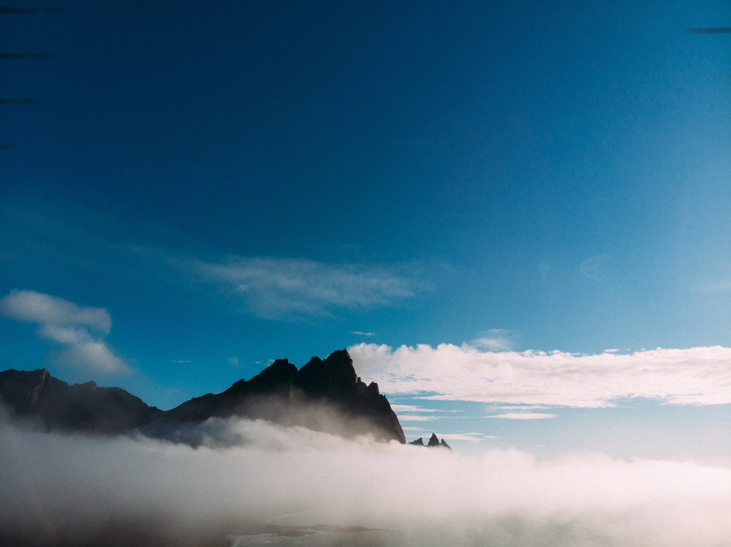
The Almannaskard Pass
This is an old part of Road 1 around Iceland, but the mountain pass can still be accessed from the North end of the tunnel, providing incredible views from the area at the top. A tunnel is now the main route through this area, which goes underground for almost a mile.
I managed to get above the mist and saw a Brocken spectre, which is where the sun casts your own shadow on the fog below.
TIP, go through the tunnel, take the first left and head back up the hill, you can park at the top.


![Viking Village - [64.2586105,-15.0942715] - DJI Mavic Air Drone](https://images.squarespace-cdn.com/content/v1/5229b80ee4b0dbbcb4a83168/1548416049532-C2U132RTHEHR4UQF1MRJ/iceland-1-9.jpg)
Viking Village - [64.2586105,-15.0942715] - DJI Mavic Air Drone
Viking Village Prop For Movie
This place is a little hidden gem on the long drive to the north. Built in 2010 for a viking movie that was never filmed.
Universal has now taken the movie on board and this set should be being used in the next year.
TIP, this site is now closed, you may be able to get to it but it’s on private land so try and get the landowners permission first.


![The Vestrahorn [64.2586105,-15.0942715] DJI Mavic Air Drone](https://images.squarespace-cdn.com/content/v1/5229b80ee4b0dbbcb4a83168/1548416475100-SMZE8KKVI3U3XA37LFAH/iceland-1-11.jpg)
The Vestrahorn [64.2586105,-15.0942715] DJI Mavic Air Drone
Stokksnes + Vestrahorn
The Stokksnes peninsula is home to one to the most incredible mountains, the Vestrahorn; 450m cliffs rise out of the lagoon like jagged teeth, framed by black sand beaches. This whole area is breathtaking, and well worth a stop on the long drive to the north.
TIP, you have to pay to get through the barrier, there are automatic machines at the visitor centre so if you arrive [as I did] when it’s closed you can still get in.

Grass tussocks on Stokksnes - DJI Mavic Air Drone

![The view with the Hvalnes Lighthouse behind me - [64.3475639,-14.9824853] Fuji X-H1 + 16mm 1.4 lens](https://images.squarespace-cdn.com/content/v1/5229b80ee4b0dbbcb4a83168/1548417283239-MR1C0K7TVQVMFR4USJBC/iceland-1-13.jpg)
The view with the Hvalnes Lighthouse behind me - [64.3475639,-14.9824853] Fuji X-H1 + 16mm 1.4 lens
Hvalnes Lighthouse
One of Iceland’s many bright orange lighthouses on the south coast, a quick stop here to admire the views and take a breather.
TIP, the road to park here is very rough, not advised for small cars with low ground clearance.
![Sveinsstekksfoss [64.6071436,-14.6001293] DJI Mavic Air Drone](https://images.squarespace-cdn.com/content/v1/5229b80ee4b0dbbcb4a83168/1548418121153-SE6QN3I3PXYUK7D9VEGX/iceland-1-15.jpg)
Sveinsstekksfoss [64.6071436,-14.6001293] DJI Mavic Air Drone
Sveinsstekksfoss
Just before turning onto road 939 [A shortcut] is this little visited yet beautiful falls, coming down 15 meters and nestled in the Icelandic landscape. Another worthy stop on the long drive.

The Long Drive -DJI Mavic Air Drone
The Long Drive
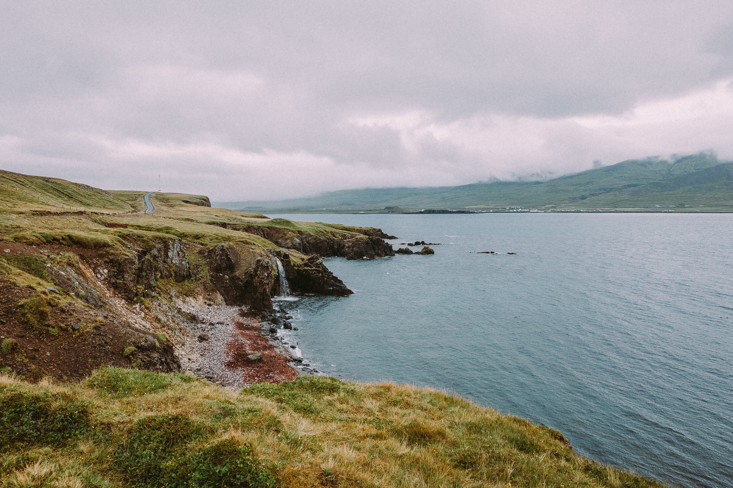
[And I mean looooooong] As you are driving around Iceland there are many rest stops and some great views to take in, the road is not one to be rushed and taking the time to stop and take it all in not only breaks up the driving but you will be rewarded with some great views. [especially if the weather is great]
Taking road 939 takes off about 45 minutes of the ring road journey and goes up and over a mountain. Closed in the winter the drive itself is stunning and well worth it, it’s all gravel road so a 4x4 is best. Along the way are great views and the odd waterfall.
TIP, the weather in these photos is VERY lucky, it’s more likely going to be raining all the time and just before I got here is was 2 weeks of rain every day. Don’t expect the sun.

View from the 939 road, this is a stunning drive. Fuji X-H1 + 16mm 1.4 lens


My plans changed a bit towards the end of day 6, instead of stoping to set up camp at this point I drove for a further two hours, just to see puffins. Worth it.

Gravel turns into the best paved road ever. Fuji X-H1 + 23mm 1.4 lens
The above map shows where I went to see puffins.
![PUFFINS! [65.5203249,-13.7898142] Fuji X-H1 + 50-140mm 2.8 lens](https://images.squarespace-cdn.com/content/v1/5229b80ee4b0dbbcb4a83168/1548419902449-HF70HALKLPG2MPYOP17G/939-9.jpg)
PUFFINS! [65.5203249,-13.7898142] Fuji X-H1 + 50-140mm 2.8 lens
Puffins
My detour for puffins was a snap decision and one that I am so glad I did, heading north along the East of Iceland you get onto road 94, and the drive along is incredible.
The mountain pass hits you in the face as you make out the winding gravel track ascending in front of you, a steep drive is broken up by the best toilet in the world with views across the valley below. As you continue on and over the mountain the road downwards turns to the best paved, winding road for about a mile, you can see clearly down the whole road and carving through the valley is one of many driving treats in Iceland.
A little further on and you reach the hamlet of Bakkagerði, the last town, continue on the road till the road stops at a small marina and you’ll be in puffin city.
About 10,000 puffins call this home, just a drop in the ocean of Iceland 3 million puffins, head up the steps to see them up close, I went back in the morning to see them with less people around.
TIP, the hut asks for a small charge for entry and it’s best to get there super early when there are many more birds around.

So many puffins.


Puffin island, behind the marina.


That ends a very long day 6, I camped in Bakkagerði and got an early night to make a good start the next day.
DAY 7.
![Litlanesfoss [65.0838326,-14.8862602] Fuji X-H1 + 23mm 1.4 lens](https://images.squarespace-cdn.com/content/v1/5229b80ee4b0dbbcb4a83168/1548434546400-ZCX17JLLIOE3S1E4VZHB/lit-2.jpg)
Litlanesfoss [65.0838326,-14.8862602] Fuji X-H1 + 23mm 1.4 lens
Litlanesfoss
I left the puffins behind and headed to two waterfalls, which while not unknown they are quieter than the ones on the South coast, and most visitors will of gone as far as Jökulsárlón and turned back towards Reykjavik. The first was Litlanesfoss, which after a short hike is bought into view, flanked by basalt columns [10-20 meters high, some of the highest in the country], and cascading 30 meters into the gorge below.
The really stunning side of it is only viewable with a drone as the opposite side of the gorge is private land.
TIP, parking gets busy here, and don’t forget to carry on walking up the hill to the next waterfall.


![Hengifoss [65.0851208,-14.8866679] Fuji X-T2 + 50-140mm 2.8 lens](https://images.squarespace-cdn.com/content/v1/5229b80ee4b0dbbcb4a83168/1548434882520-2CDNC82DWWKGITU1VWA4/lit-1-2.jpg)
Hengifoss [65.0851208,-14.8866679] Fuji X-T2 + 50-140mm 2.8 lens
Hengifoss
The second waterfall, of which you’ll see both on this walk, it falls 128 meters, characterised by red layers of clay in-between the basalt layers, about 5 million years old. It is possible to walk behind the waterfall into a small cave, but it’s hard going to get that close.
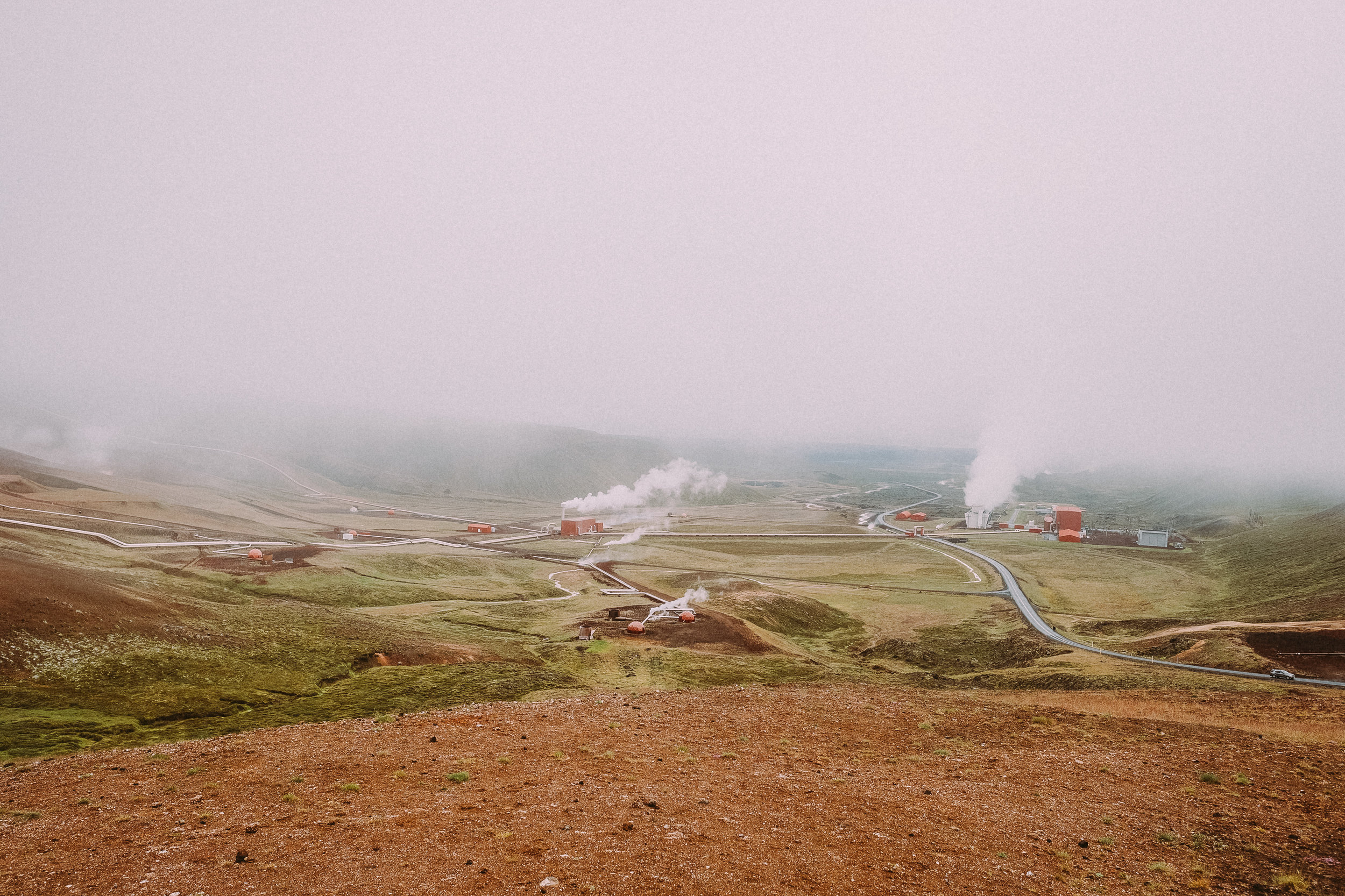
![Krafla [65.7171278,-16.7631962] Fuji X-H1 + 16mm 1.4 lens](https://images.squarespace-cdn.com/content/v1/5229b80ee4b0dbbcb4a83168/1548435324372-MC5RP8GTV452H1BDE65V/lit-1-4.jpg)
Krafla [65.7171278,-16.7631962] Fuji X-H1 + 16mm 1.4 lens
Krafla
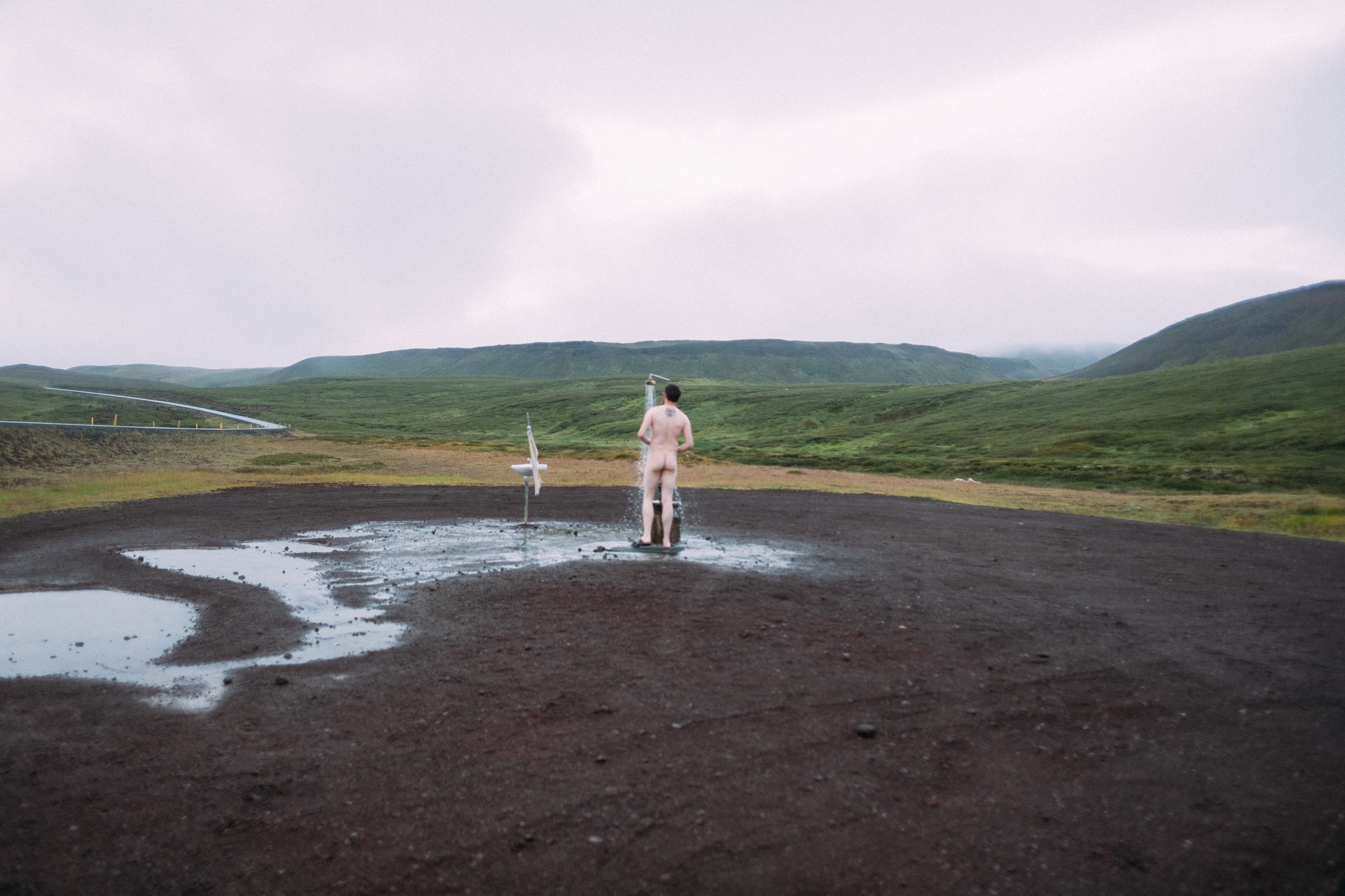
Krafla is a caldera [volcanic crater or sorts] in northern Iceland near Lake Myvatn, it is 10km wide and reaches up to 2km deep. The name of the main crater; Viti translates to “hell” as people used to believe that hell was under volcanos.
Nearby there is a geothermal power plant and by the side of the road is a warm [I tried] running shower, because why not?
It gets misty up here and I didn’t see much at all.
![Mývatn Nature Baths [65.6309012,-16.850162] GoPro Hero5 Black](https://images.squarespace-cdn.com/content/v1/5229b80ee4b0dbbcb4a83168/1548435597992-AFONCKG1F16G1V91SL45/lit-1-5.jpg)
Mývatn Nature Baths [65.6309012,-16.850162] GoPro Hero5 Black
Mývatn Nature Baths
Pretty much the Blue Lagoon of the north, this time in Iceland I didn’t plan on going to the Blue Lagoon in the south, having been a few times already I decide to give it a miss, but up in Myvatn there is a similar setup but slightly cheaper and quieter.
TIP, this is a good thing to do when the weather is not so good as it’s warm and you’re gonna get wet anyways.
![Hverir [65.643436,-16.7958178] Fuji X-H1 + 23mm 1.4 lens](https://images.squarespace-cdn.com/content/v1/5229b80ee4b0dbbcb4a83168/1548436377774-WWPODO3XM2O82XE04TPE/lit-5.jpg)
Hverir [65.643436,-16.7958178] Fuji X-H1 + 23mm 1.4 lens
Hverir
A short distance from Krafla is Hverir an area of hot springs, bud pools and fumaroles. There is no vegetation in sight, the constant toxic fumes have made the ground here sterile, the sulphur is also toxic to humans.
But toxicity aside you can spend a while here wondering on the paths and seeing this raw nature.
DON’T wander off the paths, mainly because you might drown in a pool of boiling mud.


That ends day 7, I headed to a campsite near lake Myvatn and settled in for the night.
DAY 8.
![The Game of Thrones sex cave [65.5997603,-16.8976492] Fuji X-H1 + 16mm 1.4 lens](https://images.squarespace-cdn.com/content/v1/5229b80ee4b0dbbcb4a83168/1548582507948-DEU9KU1NB13WVIA9XXN9/lit-2-7.jpg)
The Game of Thrones sex cave [65.5997603,-16.8976492] Fuji X-H1 + 16mm 1.4 lens
Grjótagjá cave
Near lake Myvatn is a thermal spring cave, up until the 1970’s the cave was a popular bathing site, but eruptions in the 70’s and 80’s rose the temperature of the water to more than 50 degrees. It is also the well know ‘Sex Cave’ from Game of thrones, just one of many Icelandic sights used for the series.
TIP, free to visit, bathing is prohibited.


![Dettifoss [65.8090442,-16.4022067] Fuji X-H1 + 23mm 1.4 lens](https://images.squarespace-cdn.com/content/v1/5229b80ee4b0dbbcb4a83168/1548437334546-HGKX2Y7IDHXHA0YVLV3Y/lit-1-8.jpg)
Dettifoss [65.8090442,-16.4022067] Fuji X-H1 + 23mm 1.4 lens
Dettifoss
The most powerful waterfall in Europe, with a modest drop [by Icelandic standards] of 45 meters Dettifoss’s most impressive feature is it’s 100m span. The water charges down at 400 cubic meters per second, to give an idea that is 4000 bathtubs full of water falling each second or as much water as London uses in a day in just under 2 hours. You can view it from two sides, but they takes ages to drive to each one so you’ll have to make a choice, I managed to get the drone out so I could get views from both angles.
TIP, it’s wet as hell here, you’re gonna get wet from the spray.


![Selfoss [65.8090442,-16.4022067] Fuji X-H1 + 16mm 1.4 lens](https://images.squarespace-cdn.com/content/v1/5229b80ee4b0dbbcb4a83168/1548437633289-KY3VNEGHBNZ86ZJW3CSL/lit-1-9.jpg)
Selfoss [65.8090442,-16.4022067] Fuji X-H1 + 16mm 1.4 lens
Selfoss [Near Dettifoss]
Selfoss is another waterfall in North Iceland, located in the Jökulsárgljúfur canyon and close to the massive Dettifoss waterfall, it’s height is 10 meters, which may seem small in Icelandic standards but it curves in a horseshoe shape and is a very stunning waterfall.
TIP, It takes about 30 minutes each way to hike from Dettifoss so it is well worth the visit.
![Whale Watching [66.0532255,-17.2307164] Fuji X-H1 + 50-140mm 2.8 lens](https://images.squarespace-cdn.com/content/v1/5229b80ee4b0dbbcb4a83168/1548437927361-USP3T5UOGQY0SZ9H0DZ7/lit-1-11.jpg)
Whale Watching [66.0532255,-17.2307164] Fuji X-H1 + 50-140mm 2.8 lens
Husavik + Whale Watching
A small town in north Iceland of just over 2000 people, made famous by it’s whale watching tours and museum.
I booked my tour for the afternoon, after a long day of driving and hiking to waterfalls, Husavik bay is an ideal place for whales watching as many species come into the bay. I managed to see Humpback whales and Minke whales, while the photos aren’t that great its a super hard thing to photograph and kinda nicer to just watch.
TIP, there are many whale tours, they take about 3 hours and are COLD, wrap up.


I left Husavik behind and headed on a long drive towards Akureyri where I would be spending the next two nights.
DAY 9.

Goðafoss
The Godafoss waterfall [The name translates to “Waterfall of the Gods”] It’s a 12m fall around a curved 30m cliff edge.
In the year 1000 the law speaker Þorgeir Ljósvetningagoði made Christianity the official religion of Iceland and it is said that he threw his statues of the norse gods into the waterfall.
TIP, very busy area with limited parking.


![Alderjayfoss [65.6421187,-17.4057632] - DJI Mavic Air Drone](https://images.squarespace-cdn.com/content/v1/5229b80ee4b0dbbcb4a83168/1548438632085-JFFSF1TC9OKX95WFDU3T/lit-1-14.jpg)
Alderjayfoss [65.6421187,-17.4057632] - DJI Mavic Air Drone
Alderjayfoss
A very quiet waterfall on the 842 road South from Godafoss, well worth the visit but a 4x4 is best for getting here.
It’s another basalt column waterfall of immense volume, you can walk around to get closer to the falls and there is a great view from the cliff in front of it.


![I didn’t take many photos in Akureyri, but this one of the traffic lights stood out. They did this during the 2008 financial crisis to life peoples mood, they liked it so much they have kept them. [65.6240766,-18.2152425] Fuji X-H1 + 23mm 1.4 lens](https://images.squarespace-cdn.com/content/v1/5229b80ee4b0dbbcb4a83168/1548436690026-IZD491123F2P3TAW1XTC/lit-1-7.jpg)
I didn’t take many photos in Akureyri, but this one of the traffic lights stood out. They did this during the 2008 financial crisis to life peoples mood, they liked it so much they have kept them. [65.6240766,-18.2152425] Fuji X-H1 + 23mm 1.4 lens
Akureyri
Known as the Capital of the North and well worth a stop over to re-fuel and get some food, its a rather small town [18,000 people] with a stunning Cathedral. There are 5 police officers in Akureyri and there have been incidents where there weren’t enough officers on duty to respond, but it’s all good as Iceland has one of the lowest crime rates in the world.
I took a couple of nights here in a hotel to rest and re-set, interesting is that the hotel is a boarding school in the winter when the children can’t travel in and out and in the summer they are converted into temporary hotels.
END OF PT.2
I got my head down for a decent night sleep before an early start for a long drive towards the West, in my original plan I was going to visit the Westfjords, but I chose to stay longer here in the North and do the Westfjords another time and take more days to do it.
On this leg of the journey I drove about 580 miles.
Join me for part 3 coming real soon!
Thanks for reading.


